Surfin’: Field Day Planning
By Stan Horzepa, WA1LOU
Contributing Editor
This week, Surfin’ considers potential new tools for Field Day operators.
ARRL Field Day is four months away, but it is not too early to start planning for the big ham radio event. In fact, James Whitfield, N5GUI, has started planning and would like some help developing a tool that would enhance Field Day operations. I will let James tell you what he has in mind.
“Over the past week I have been trying to do some Field Day planning for our local club stations. What I wanted to do was get a general sense of the number of contacts that could be gathered depending on what direction I pointed a particular antenna.
“I did a web search and found your article “Finding Where the Hams Are” (also see “Still Finding Where the Hams Are”). That in turn led me to a site that listed the number of active ham licenses in each state. I transferred the numbers to a map of the US. From the 2010 ARRL Field Day results, I obtained the number of entries for each ARRL Section and also produced a US map with that data.
“On both maps, I drew range circles at 250 mile increments centered on my location of Wichita, Kansas. I can then overlay an expected far field antenna pattern. From that I can make some educated guesses about antennas.
“Say I wanted to use an unterminated V beam on 15 meters --- since it is a simple, bi-directional gain antenna, there might be interference issues from Los Angeles if I used it for Virginia and vice versa. On the other hand, pointed toward New England, the back side would get mostly Pacific Ocean.
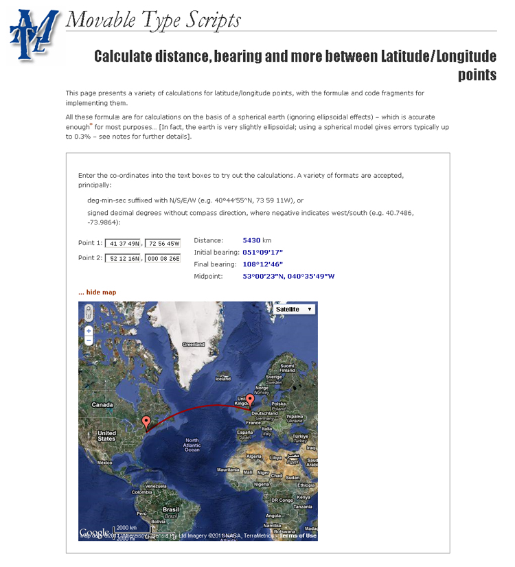
“As I said, the research started on the Internet. I found some interesting sites that give distance between map points, sites that give the latitude and longitude and others that give distance and bearing from co-ordinates. None that I found would give bearing from selected points on a map. That would have been helpful for my research.
“While thinking about my ‘want list’ for websites, I thought you might pass along ideas to your more capable audience, as well as providing gems for the rest of us.
“What would seem to be useful would be a map that allows the user to select an origin point, then antenna centerline and beam width. From that it should be possible to query a database (license database or previous Field Day entries) for candidates along the path corresponding to distances.
“Another useful planning tool would be expected radio operation distances for any given band at say sunrise, mid-morning, noon, mid-afternoon, sunset, evening, midnight and the wee hours. There would certainly be a lot of variability, but some numbers that make a little sense would be better than a lot of gobbledygook that remain incomprehensible, if scientifically precise.”
So that is what N5GUI has in the works. If you have anything that can assist him in his project, contact him directly and share your thoughts with me so I can pass them on to the rest of the Surfin’ audience.
Until next time, keep on surfin’!
Editor’s note: Stan Horzepa, WA1LOU, plans to have a new portable HF radio for the 2011 ARRL Field Day. To contact Stan, send e-mail or add comments to the WA1LOU blog.
Photo Gallery
-
 ARRL Contributing...
-
 Websites that cal...

Back


