The K7RA Solar Update
Solar activity dropped again this week, although it is now gradually strengthening. The average daily sunspot numbers declined nearly 16 points to 11.7, and average daily solar flux dropped more than 5 points to 75.8. Over the next two weeks, the solar flux is expected to gradually increase from 80 on October 15-16, 82 on October 17, 84 on October 18-22, 80 on October 23-25 and 85 on October 26-29.
Sunspot numbers for October 7-13 were 0, 11, 12, 13, 11, 11 and 24, with a mean of 11.7. The 10.7 cm flux was 75.1, 74.9, 76.4, 75.9, 75.3, 75.2 and 78.1, with a mean of 75.8. The estimated planetary A indices were 4, 4, 4, 2, 20, 10 and 4, with a mean of 6.9. The estimated mid-latitude A indices were 2, 3, 3, 1, 10, 7 and 3, with a mean of 4.1.
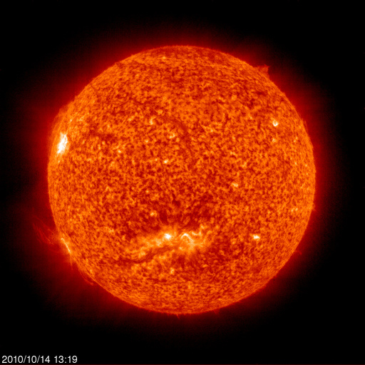
The reporting week runs through Wednesday, October 13, and on Thursday, October 14, the sunspot number rose from 24 to 34 and solar flux increased from 78.1 to 80.4. The increase is expected from sunspot group 1112 -- emerging on October 9 -- and group 1113, which appeared on October 13, rotating over the Sun’s eastern limb. On October 14, new sunspot group 1114 appeared. The STEREO mission shows a series of magnetically active areas on our Sun’s far side, which will gradually rotate into view.
A very rough estimate of the transit time involved can be made by assuming that a full rotation of the sun is about 27.5 days. Each of those 12 longitudinal divisions on the rotating solar globe at the STEREO site therefore each represent approximately 55 hours, or about 2.29 days. This can be used as a rough guide to the time it takes for any area of interest to move over the eastern horizon.
Geomagnetic activity is expected to be stable, with the planetary A index moving between 5 and 8. The predicted planetary A index is 7 on October 15, 8 on October 16-17, 5 on October 18, 7 on October 19-20, 5 on October 21-23, 8 on October 24-25 and 5 on October 26-29. The Geomagnetic Department of Geophysical Institute Prague predicts quiet conditions on October 15, quiet to unsettled October 16, quiet October 17-20 and quiet to unsettled again on October 21. Over the past week, the most active geomagnetic day was Monday, October 11, when the planetary A index was 20 and the planetary K index went as high as 5. Alaska’s College A index was 49, based on a College K index as high as 7. This activity was pushed by a strong solar wind.
There is an interesting and educational Web page devoted to heliophysics from the University Corporation for Atmospheric Research in Boulder, Colorado.
Richard Dowty, W7EET, of St Paul, Oregon, isn’t sure what to do with the data presented in this bulletin. He would rather see reports that predict the MUF (Maximum Usable Frequency) for the next week, telling him which bands will be good or bad, as well as information of a more practical nature.
One problem with this is that MUF (Maximum Usable Frequency) is different for different paths and at different times. Generally, MUF should be higher when there are more sunspots. We could make very general statements such as “West Coast stations should be able to hear Japan on 20 meters from 2000-0230 and again at 0400-0430, with best signals from 2030-0030, and 17 meters at 2130-0130,” but that projection was actually done for Seattle. A similar prediction for San Diego (two extremes) should say 20 meters to Japan from 2030-0330, with signals 5-10 dB lower than the path from Seattle, and 17 meters from 2100-0300. One could pick a mid-point, such as around Red Bluff or Garberville, California, but this produces a third set of data that doesn’t really apply to the north and south West Coast extremes.
Years ago, this bulletin would pick some point somewhere in North America and make projections toward different continents. An example is in bulletin 16 from 1999. This sort of information was very popular, but the bulletin wasn’t big enough to handle all of the permutations of predictions for many locations to many other locations. But now we have some good free tools for doing this, such as W6ELprop. This way you can see what likely propagation might be from your location to anywhere else, and this works better than reading a generalization in this bulletin.
Propagation programs are designed to use the projected smoothed sunspot number for the month, which you can find in about every fourth issue of the Preliminary Report and Forecast. For example, if you look at page 10 in issue 1831, it shows a predicted smoothed sunspot number of 33 for October 2010. The smoothed number is actually an average of monthly sunspot numbers for one year -- six months forward and six months back -- so half the data that goes into this average is the predicted data for the next six months, while the rest is the record of sunspot numbers for the last six months. Propagation programs then make a prediction that basically says half the time conditions will be better than this value, and half the time worse.
W6ELprop can handle either sunspot numbers or solar flux, and for a more recent set of data, some have suggested just averaging the past five days of solar flux found here and using that number. W6ELprop also uses K index, and you can get the most recent mid-latitude K index found here. But no propagation program is designed to make predictions based on daily fluctuations of either solar flux or sunspot number.
To find the latitude/longitude coordinates for you location, just go here and enter an address. In this example, I will use 2832 SE Indiana Ave, Topeka, Kansas, and click “Search Maps.” Just above the upper-right corner of the map, click on “Link” and hit CTRL-C to copy the link displayed, and then paste it into Notepad or some other editor by hitting CTRL-V.
Find the address in the link you’ve just pasted, and note that the coordinates are just to the right, listing latitude first, longitude second. In this case it is 39.015909 and -95.660564, which can be expressed as 39.02 or 39.016 degrees North latitude, and 95.66 or 95.661 degrees West longitude. Note the convention is for longitude to be expressed in degrees East, so West longitude appears as a negative number. W6ELprop uses the opposite convention, so West longitude is a positive number. You can use this method to find coordinates for any location of interest and enter it into the atlas portion of W6ELprop for future reference.
Click here for a good tutorial and look for the title “An Introductory Tutorial to W6ELprop.”
In closing, check out the November 2010 issue of QST for an article about using WSPR for studying propagation paths, beginning on page 30.
All times listed are UTC, unless otherwise noted.
Amateur solar observer Tad Cook, K7RA, of Seattle, Washington, provides this weekly report on solar conditions and propagation. This report also is available via W1AW every Friday, and an abbreviated version appears each Thursday in The ARRL Letter. You can find a guide to articles and programs concerning propagation here. Check here for a detailed explanation of the numbers used in this bulletin. An archive of past propagation bulletins can be found here. You can find monthly propagation charts between four USA regions and 12 overseas locations here. Readers may contact the author via e-mail.
Photo Gallery
Back


