RFinder Now Includes Coverage Maps
In February, ARRL announced it had established an agreement with RFinder, the creator of a web and app-based directory of Amateur Radio repeaters worldwide, to be its preferred online resource of repeater frequencies. RFinder has now announced that through a new strategic alliance with CloudRF.com, users will now have coverage maps for all repeaters on earth. “Our systems are busy rendering and indexing coverage maps based on ground path loss using the Longley-Rice irregular terrain model,” said Bob Greenberg, W2CYK, creator of RFinder — The Worldwide Repeater Directory. “We have worked with Alex Farrant, M6ZUJ, creator of CloudRF.com, to render coverage maps for nearly the entire collection of repeaters in RFinder's database.”
"CloudRF is honoured to have been chosen to support the world's premier repeater database with coverage maps. We look forward to working with RFinder to improve RF coverage maps for the world. RFinder is by far the largest collection of transmitters we have seen and we are excited to be part of this ground breaking project." says Farrant. "Bob contacted me in late February about our API. Several days later he had his own client script and had rendered most of his substantial database of repeaters at 100 mile radius each using CloudRF's powerful servers. Bob was able to efficiently outsource the substantial horse power and reference data required for this mammoth task and download each site afterwards as a KMZ overlay for Google earth and host them himself. Best of all, most of the hard work was done whilst we were sleeping!"
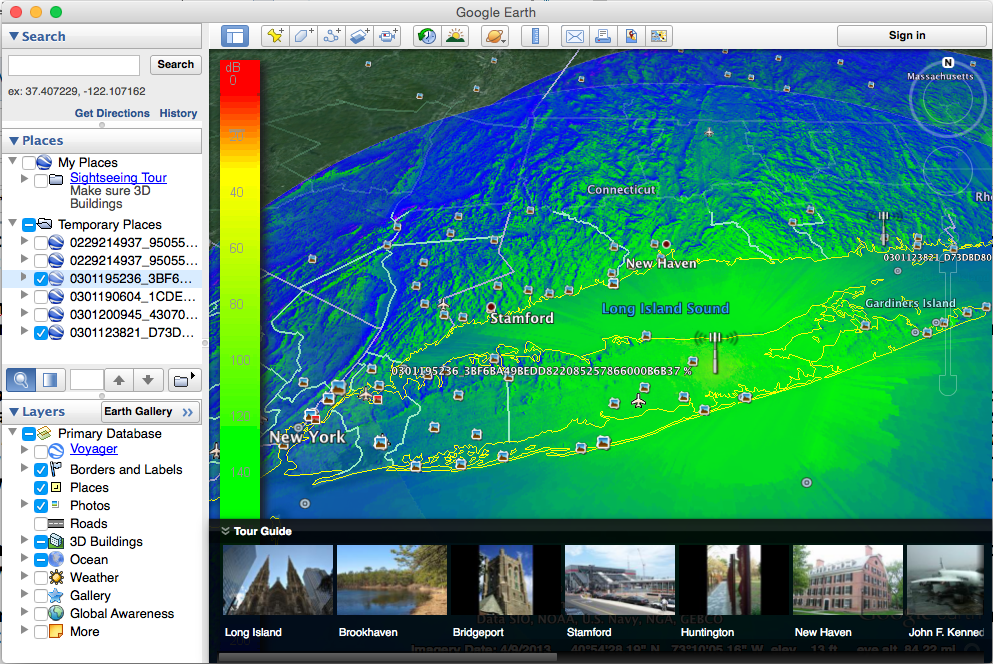
The resulting KMZ files are viewable in Google Earth on Windows and Mac (through web.rfinder.net and routes.rfinder.net), on Android and iOS versions of RFinder. The Windows and Mac versions allow multiple coverage maps viewable simultaneously, a great aid to repeater coordinators worldwide.
As part of this project, RFinder will be providing complimentary access to repeater coordinators worldwide. As coordinators update repeaters with HAAT, Power and Gain and updated Lat/Lon, maps will be automatically re-rendered within a few minutes and made available to all subscribed users. The procedure to sign up for the repeater coordinator program will be announced later this month (March 2016). This new capability will make repeater coordinators more efficient, as they will easily be able to see repeater coverage maps side by side for both coordinated and uncoordinated machines. This information is critical as simplex nodes for internet linking, crossband repeaters and homebrew repeaters crop up worldwide using various new out of the box and homebrew technologies.
For a limited time, users of the trial version of RFinder on Android will have access to coverage maps. After that only subscribers will have access. An annual $9.99 subscription to RFinder provides access to repeater data, worldwide, through its collection of apps for Android and Apple devices, and from nearly any web browser. A single subscription provides access through web.rfinder.net, routes.rfinder.net, Android, iOS, RT Systems and CHIRP, as well as POI files for popular GPS systems.
Subscribe to RFinder by visiting http://subscribe.rfinder.net from your iPhone, iPad, iPod Touch, or from your Android smartphone or tablet. Those without an Apple or Android device can subscribe using the link at the bottom of http://subscribe.rfinder.net/. RFinder will have an exhibit in the ARRL EXPO at the upcoming Dayton Hamvention®, May 20-22, 2016 in Dayton, Ohio.
Photo Gallery
Back


