The Amateur Amateur: APRS Sneaks Into the Shack
By Gary Hoffman, KB0H
Contributing Editor
As I stated in my last column, APRS (Automatic Packet Reporting System) had interested me for some time. I just couldn’t seem to find any documentation that was simple enough for me to understand. Nor did there appear to be any “starter kits” on the market.
All that changed when I discovered the Byonics MicroTrak Ready-To-Go, which, for me, was literally an APRS starter kit. It was easy to install and no assembly required, just what I needed.
After installing the MicroTrak in my SUV, I spent a long time sitting in front of my computer, watching a little red automobile icon labeled with my call sign. I’m not sure what I was expecting it to do -- especially since my SUV was parked in my garage -- but I just sat there, transfixed by the image.
Eventually I began to look at the other information that was displayed on the screen. There seemed to be a lot of it. I found that my vehicle hadn’t sent any telemetry, bulletins, messages or weather reports, but it did send out a status, comment and something called a Mic-E message. I also found a list of every packet that my SUV had sent over the last two days.
A lot of what I saw on my computer screen was very cryptic. And since it was my vehicle and my call sign, I was curious to find out what it all meant.
This prompted me to do some serious searching on the Internet. And though my earlier efforts had mostly yielded a lot of technical talk that went way over my head, this time I was able to find some Web sites that helped to make much of it clear. (See info.aprs.net, aprs.org, and wa8lmf.net/aprs.)
One thing that quickly became apparent was that tracking a vehicle via APRS was nothing like the CIA would do, tracking someone using drone aircraft and satellites. An APRS track is dependent on how often the vehicle transmits a signal (the MicroTrak does it once every two minutes) and whether or not there are any stations close enough to hear the signals; even in an urban area, you may find that a track of your vehicle shows you frequently driving off the road. In a rural area, a track of your car will almost certainly drift off the road and go through rivers and corn fields.
Before I got into APRS, I had often wondered just who -- or what -- picked up the transmissions. All of my previous experience with packet radio involved one station making direct contact with another station via “connect” mode. How did it work with APRS?
I found that APRS transmissions are “unconnected.” Although there is a destination listed in APRS packets, it might be generic rather than specific. Some packets may be intended for a particular individual, but a lot of them just say, “Here I am!”
But I was curious as to how the packets got anywhere at all. Most APRS activity seemed to take place on a single 2 meter frequency, 144.390 MHz. Were there 144.390 repeaters all over the place?
Apparently, yes there were, though they were called digipeaters.
But I wondered, wouldn’t a signal repeated by a digipeater be picked up by another digipeater and be repeated again and again ad infinitum? Wouldn’t the very first APRS packets still be bouncing around out there?
They aren’t, of course, and that’s when my research led me into more complex matters.
By this time, though, I’d absorbed enough background information that the technical stuff wasn’t quite as daunting as it had been the first time I’d read it. Transmitted APRS packets had “destination paths” that limited how many times they were to be repeated. Digipeaters checked and altered the packets to show that they had gone through another repeater. It was all starting to make sense.
In addition to digipeaters, I discovered that there were stations called IGates. These stations were connected to the Internet. They not only sent and received APRS packets (and perhaps digipeated them as well), they also communicated with APRS servers. In fact, there was a whole APRS Internet network that shadowed what was on the air.
And that, it seemed, was how the little bleeps sent out by my MicroTrak wound up on my computer screen.
I mentioned that even in an urban area you might find an APRS track showing your vehicle frequently leaving the road. After I’d had my MicroTrak for a while, I found that my trips to the grocery store or the gas station usually showed more of an “as the crow flies” track than an accurate trace along the local streets. By and large, any trip I made around Florissant -- the suburb of St Louis where I live -- tended to have a lot of gaps, places where my APRS packets were not received or repeated. I knew that the Boeing Employees Amateur Radio Society, W0MA (BEARS), had a digipeater nearby. But I also knew that much of Florissant, “Valley of the Flowers,” literally was in a valley, a radio sink-hole.
During my fanatical researches of APRS, I came across references to something called a “fill-in” station. It is essentially a more localized version of a wide area digipeater. It is meant to “fill-in” those gaps that the main digipeaters cannot see. More often than not, a fill-in station is located at some Amateur Radio operator’s home.
Right then I knew that I wanted to set up a fill-in station. Maybe an IGate as well.
Okay, this was no longer a research project. It was a mission. I tell you, the APRS bug had bitten me hard.
Despite my enthusiasm, though, I knew this would not be an easy task. I had all of the necessary hardware, having already operated packet radio in connected mode. What I needed now was APRS software.
I found three candidates right away -- UI-View, WinAPRS and XASTIR -- though there are more. I downloaded and attempted to install the ones mentioned, and ran into problems with all three.
I put XASTIR on my Linux system, only to find that my Linux system wasn’t up to snuff.
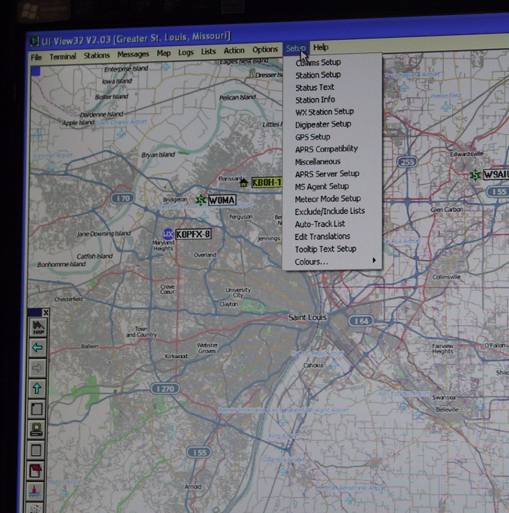
UI-View installed, but appeared to have an infinitely complex setup procedure.
I honestly don’t know what went wrong with WinAPRS. I simply couldn’t install it.
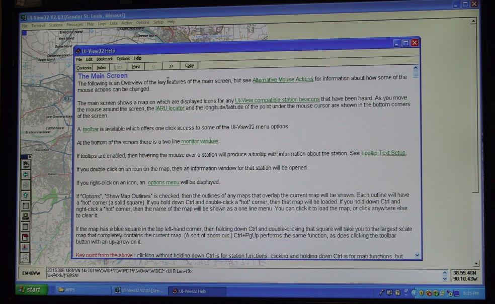
Well, UI-View had, at least, installed. I decided to play around with it. It did have an extensive Help file. In fact, the “setup” portions of UI-View were rather insistent that I use it. And it did help, to some extent.
I was able to make a connection to my TNC (terminal node controller). That part was fairly straightforward. And as soon as I had done so, UI-View started talking to me. I mean it actually talked to me. Every time the TNC sent it APRS-formatted packets, a British-accented voice would announce the call sign of the sending station over my computer’s speaker.
That was a great sales pitch. If someone found the prospect of trudging through the rest of the lengthy setup menu too overwhelming to contemplate, hearing that voice would certainly urge them to continue. It was a nice touch.
I pressed on. I got through another section of the setup menu, though I wasn’t entirely sure what I was doing. I kept running into terms and concepts that weren’t described in the Help file.
Eventually I had a functioning APRS station, in that it automatically sent and received APRS packets. But that was all it did. Other than the “receiving” part, it wasn’t much different from the transmit-only MicroTrak in my SUV.
The digipeater setup had me baffled.
The IGate setup was beyond my comprehension.
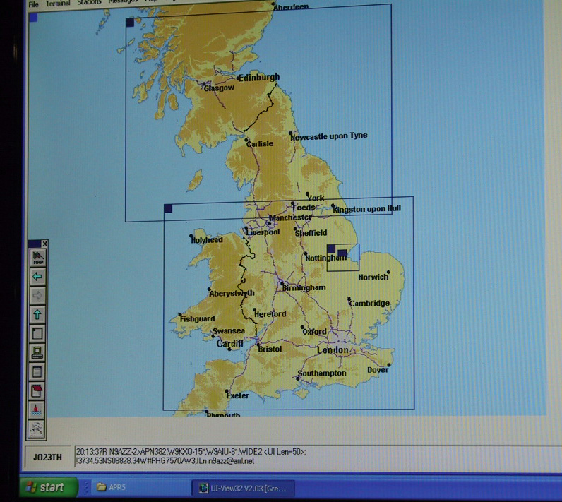
Even the maps seemed to be limited to the British Isles or a map of the whole world.
It was time to get some serious help.
Next time: Rick Crockett, W0PC, to the rescue.
Editor’s note: ARRL member Gary Hoffman, KB0H, lives in Florissant, Missouri. He’s been a ham since 1995. Hoffman says his column’s name -- “The Amateur Amateur” -- suggests the explorations of a rank amateur, not those of an experienced or knowledgeable ham. His wife, Nancy, is N0NJ. Hoffman has a ham-related Web page. Readers are invited to contact the author via e-mail.
Photo Gallery
-
 ARRL Contributing...
-
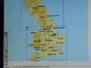 The only maps tha...
-
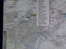 The UI-View setup...
-
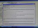 UI-View did, howe...

Back


