Surfin’: Google Earth Radio Tricks
By Stan Horzepa, WA1LOU
Contributing Editor
This week, Surfin’ features guest columnist Mike Schaffer, KA3JAW, of September 7 Surfin’ fame.
Upon posting my rare, out-of-season Costa Rican analog television Sporadic-E 1240-mile distance video on YouTube, I was curious about the broadcast towers’ location and appearance.
In my pursuit of this quest, I visited Wikipedia to obtain some information; however, it only mentioned that Channel 4 is a private Costa Rican television channel owned and operated by Repretel that was founded in 2000.
After searching the Internet for more information, I found William Hepburn’s Central America and Caribbean TV station lists. After clicking on the “Central America” tab, a country list appeared with technical data, such as analog channel, video offset frequency, call sign, network/slogan, city, power (kW), latitude and longitude. This source indicated that the transmitter has a “Z” offset (video carrier assigned to 67.250 MHz), and a call sign of TIIVS, which is assigned and located at Volcan Irazu, near the capital of San Jose and runs 10 kW ERP.
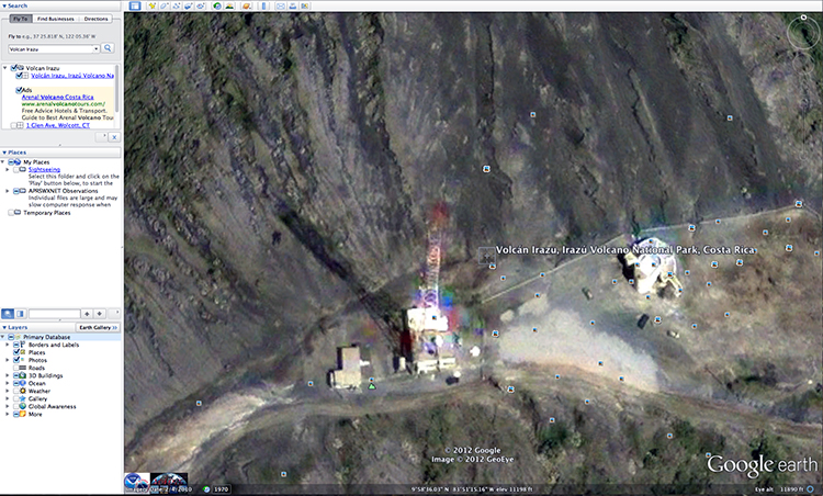
With this information, I ran Google Earth. For those not familiar with this program, Google Earth lets you virtually fly anywhere on Earth to view satellite imagery, maps, terrain, 3D buildings, galaxies in outer space and the canyons of the ocean.
Within Google Earth, I used the search box to enter “Volcan Irazu.” This results in an overhead satellite view of that location. You will notice a red pushpin on the spot you entered in the search box. There are also very small, 3/8-inch photo icons overlying the satellite image at various locations.
Since the image covers a large land mass, move your mouse over the red pushpin and use its scroll wheel to scroll up to zoom in on the image. Keep zooming until you see a broadcast tower and a white observation structure to the right of the tower. If you zoomed in too far, use your mouse scroll wheel to scroll down to zoom out.
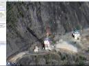
The photo icons in the image represent photos uploaded by individuals who have visited this location. If you move your mouse over the second picture icon east (right) of the tower, it displays the title “Antennas de radio y television de Costa Rica en Volcan Irazu.” Click on it and a photo of the tower will appear!
Note that you cannot save or copy images to your computer from within the application, since they are copyrighted material.
There is one feature that I really like: The geographical coordinates (latitude/longitude) and elevation that approximates the elevation of your view when you move your mouse over a spot on the map.
Now that we know what this tower physically looks like, we can search one more source: YouTube. After performing a search, I found three videos that showed the broadcast tower.
In one video, I learned that Vulcan Irazu is a National Park in Cartago province, 15 miles east of the capital. It is the highest (11,260-foot elevation) active volcano in Costa Rica. From Lookout Point, it is possible to see both the Atlantic and Pacific Oceans.
Here are the three videos:
Until next time, keep on surfin’!
Editor’s note: Stan Horzepa, WA1LOU, seeks the unusual in radio. To contact Stan, send e-mail or add comments to the WA1LOU blog.
Photo Gallery
-
 ARRL Contributing...
-
 Google Earth reve...

Back


