ARRL

Register Account

Login Help

TI-2: Remote Sensing and Data Gathering

TI-2 Connect Science and Math Concepts to Engineering and Technology

There has been increasing interest among educators in high altitude balloon and robotic deplOlde_Towne_MS_Balloon_Launch_4_2011_024.jpgoyment of sensors to study remote and inhospitable environments. These kinds of activities are a good example of content that connects the science and math of STEM with the technology and engineering real world applications of those fundamental concepts.

The purpose of the TI-2 Remote Sensing curriculum is to focus on the basic electronics behind the employment of sensors (temperature, pressure, position, humidity, etc.), analog to digital conversion techniques and the microcontroller programming involved in accessing sensors, and the use of radio (packet radio-like data links) that connect sensor outputs to the user. Once the basics of remote sensing are introduced, teachers assemble a buoy system for deploying sensors to do environmental studies. Other deOlde Towne Middle School picture of Film Canisters taped together in pairs with pink tapeployment systems on land and marine robots as well as high altitude balloons will be discussed.

The end goal of the TI-2 Remote Sensing is to provide the in-depth knowledge and tools teachers need to help their students actually “do” remote sensing from start to finish, develop the sensor packages, collect the accumulated data, and perform the math to make sense of the data. The aim is that students will be using technology to do active research.

Applicant Eligibility

Though participants need not hold an Amateur Radio license to enroll in the introductory TI-1, to be considered for a seat in TI-2 Remote Sensing, participants must possess at least a Technician class license at the time of application. Previous participation in the TI-1 is required. ARRL membership is also required.

An overview of the topics covered at TI-2:

  • TI-2 Agenda

    This advanced Institute focuses on the basic electronics of sensors (temperature, pressure, position, humidity, etc.), the analog to digital conversion of sensor data, the microcontroller programming involved in accessing sensors, and the use of radio to connect sensor outputs to the user. Once the basics of remote sensing are introduced, teachers assemble a buoy system for deploying sensors to do environmental studies.

    TI-2 also includes a demonstration of telemetry data gathering from amateur satellites, basic amateur satellite operation, and a discussion of applications of the satellite data to math and science topics. TI-2 participants will learn how to configure the Boe-Bot® robot provided in the introductory workshop for MAREA - Mars Lander Amateur Radio Robotic Exploration Activity - operation.

    • The basic electronics of various sensors likely to be used in the classroom (temperature, pressure, humidity, ozone, GPS)
    • The basic microcontroller techniques used to access and process the signals produced by the sensors 
    • The basic intra-sensor-package communications techniques used to connect the sensors of the packages to the controlling microcontroller 
    • The basics of the science of data linking radios that connect the sensor packages remotely to the users, including the use of APRS as a ham radio data link system for remote sensing
    • The mathematics and math related technologies (graphing calculators and Excel spreadsheet programs) needed to manipulate the raw data collected into meaningful measurements
    • Demonstrations of the various delivery and deployment methods for remotes sensing including water and land based buoy system, high altitude balloon systems, satellite based system, and earth bound and planet-bound robot systems
    • Discussions on the liabilities, dangers, and safety related to projects such as remote buoys and high altitude balloons
    • Introduction to satellite communications

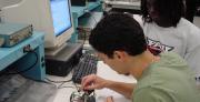
Taking Technology to the Classroom

Two teachers do analog to digital conversion of temperature readings from a thermistor at the TI-2 Remote Sensing,

Teachers do analog to digital conversion of temperature readings from a thermistor at the TI-2 Remote Sensing, hosted by Dayton Amateur Radio Association in Dayton OH July 2013. 


  • TI-2 Curriculum and Agenda

    Here's an outline of the topics covered at the TI-2 Remote Sensing. Learn More

  • TI-2 Application

    TI-2 Remote Sensing Application Learn More

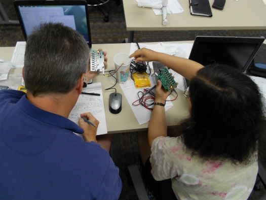
Teachers Assemble a Marine Buoy

Two teachers are working together on a buoy collaboration inside ARRL in a Teachers Institute session.

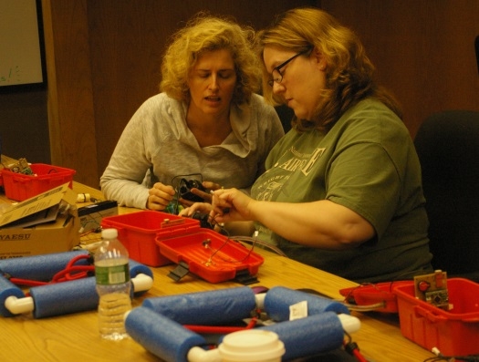
Read more about the 2014 pilot of the marine buoy at the TI-2, Remote Sensing and Data Gathering.

EXPLORE ARRL

Instragram     Facebook     Twitter     YouTube     LinkedIn